哈尔滨松花江导游词3篇
松花江是中国东北地区的一条河流,是黑龙江的最大支流。下面是带来的哈尔滨松花江导游词,希望对大家有帮助。
篇一:哈尔滨松花江导游词
松花江是黑龙江的最大支流。本身也有两条主要支流,其一为源于白头山天池的第二松花江,另一为源于小兴安岭的嫩江,两条支流在扶余县汇合始称松花江,折向东北流至同江县注入黑龙江。全长一千八百四十公里,流域面积五十四万平方公里。松花江流域范围内山岭重叠,满布原始森林,蓄积在大兴安岭、小兴安岭、长白山等山脉上的木材,总计十亿立方公尺,是中国面积最大的森林区。矿产蕴藏量亦极丰富,除主要的煤外,还有金、铜、铁等。
松花江流域土地肥沃,盛产大豆、玉米、高粱、小麦。此外,亚麻、棉花、菸草、苹果和甜菜亦品质优良。松花江也是中国东北地区的一个大淡水鱼场,每年供应的鲤、卿、鳇、哲罗鱼等,达四千万公斤以上。因此松花江的确是东北地区的一条大动脉。
冬季的松花江,气候严寒,有时会降至摄氏零下三十度,结冰期长达五个月。但是在丰满水电厂这一段从不结冰,据说是因为通过发电厂流入江里的水温甚高所致。这一段夹带暖流的江面,不断冒起团团蒸汽,凝结在岸边的柳丝、松叶上,形成一簇簇、一串串晶莹似玉的冰花,十里长堤顿时成了玲珑剔透、玉树银枝的世界。这就是闻名全国的“树挂”奇景。
冰灯是松花江流域一种特有的民间艺术,每当千里冰封的季节,家家户户的屋檐下,便会悬挂起一盏盏别出心裁的自制冰灯。所谓冰灯,是真正用冰制成像玻璃一样的灯罩,可以点上烛火。根据东北文献记载,早在清代已有冰灯制作,历史相当悠久。初期的冰灯,不过是当地贫穷人家过年过节时张挂的一种简陋装饰,其后才逐渐发展成为造型复杂、多姿多采的冰制艺术品。

篇二:哈尔滨松花江导游词
欢迎大家来到这!我是你们的导游,我姓x,大家可以叫我小x。为了便于大家参观游玩,下面我首先大家介绍一下。
松花江,它像一条银白色的丝带,盘绕在黑龙江省这只巨大的“天鹅”身上,与哈尔滨这颗晶莹的珍珠相映衬,更加显示出她的美丽与迷人。
哈尔滨的春天,总是姗姗来迟。江南已“春城无处不飞花”了,而冰城仍冰封雪冻,人们渴盼着春的来临。几阵大炮轰鸣,炸开了冰封雪冻的江面,巨大的冰排随流而下, “大江东去,浩荡谁能拒?”气势好磅礴啊!岸上观看的人不禁狂呼:“春天来了!”温暖的春风悄悄地吹绿了松花江两岸,也吹绿了绿树新芽。这一切似乎在欢迎春姑娘的来临,庆祝松花江的复苏。
盛夏,松花江南岸,鲜艳的花朵绽开了脸,柳树柔软的枝条随着轻快的乐声翩翩起舞,仿佛在向游人致意。斯大林公园、防洪纪念塔下,无数的游人来往穿梭,都被这松花江的美景陶醉。在波光似锦的江面,一叶叶小舟随波荡漾,游人们在江中游泳,红白相间的游泳帽及五彩缤纷的太阳伞构成了一幅色彩丰富的美丽画面。
松花江北岸的太阳岛树荫浓密,景色幽美,使游人流连忘返。有的游人拿起照像机摄下这难忘的瞬间,有的游人在树荫下休息野餐。人们尽情地迷恋在这绿色的大自然中。
深秋,金黄的落叶落在江面上,像是银色绸缎绣上金色的花朵,秋风送爽,江面上一片繁忙的景象,船来船往像穿梭。松花江水波浪滔滔,肩负着重荷。为了哈尔滨的振兴和经济繁荣,为祖国的四化建设默默地出着力!松花江水啊,你千百年来长流不息,我要为你唱一曲赞美的歌。
严冬,松花江却是另一番景象。在封冻的江面上,小朋友在冰上抽陀螺,打爬犁。 游人乘着冰帆,马拉爬犁。在摄氏零下30多度的气温下,水里还有人游泳,有老人、青年、少年,男的也有女的。看啊,游泳的人们意志是多么顽强,他们劈波斩浪,在水面上激起了朵朵浪花。
今天我的讲解就到此结束了,下面是大家自由参观的时间,我们大概在30分钟后在门口集合,希望这次参观能给大家留下一个深刻的印象,预祝大家能玩的开心,谢谢!
篇三:哈尔滨松花江英语导游词
A famous river divides Harbin into the north and the south part, along its bank formed two amazing riverside parks. That is the Mother River of Harbin—Songhua River.
Songhua River, ranks the fifth longest river in China, runs about 1,897 kilometers long and covers a drainage area of 545,600 square kilometers. The source of the river is a crater lake called Heavenly Lake with an elevation of 2,189 meters at the top of the Changbai Mountain, which borders North Korea in China’s Jilin Province. The water falls down from the Heavenly Lake and forms a waterfall, as if the water rushes down from haven. Hence the local Manchu inhabitant called it “Heavenly Lake” in meaning, “Songga-liwula” in pronunciation. Now we transliterate into Chinese Songhua River.
It is 4 meters in depth and 1 kilometer in width on average in Harbin sector. Songhua River has more than 900 branches in large and small size. The river is frozen over from November to April the nest year. the period of freezing weather is 135 days.
As the largest branch of the Heilong River, Songhua River winding through Harbin for 117 kilometers and served as an important artery for the development of the city. In the 17th century, under the reign of Emperor Kangxi, naval ships were stationed along these areas, and resisted the invading Russian enemy successfully. After that, in 1689, Sino-Russian Treaty of Nerchinsk was signed. That is the first border agreement between the Qing government and the imperial Russian government. On June 6th, 1898, a Russia warship taken on the engineers and surveyors to made a topographic map for building the China-East Railway. There landing point is where the Flood Control Monument located now. From then on, the river became busy and lots of material needed for build the railway were transported through this River and then, a modern city was erected at the south bank of Songhua River.
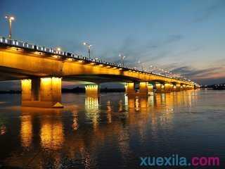
Three big bridges have been built over the river, and one of them connected the south bank of Harbin and Sun Island was built in 1983 and opened to traffic in 1986. This bridge approach or the leading bridge on the south bank of the Songhua River was designed to have two circles. So the whole bridge was like a scissors and the bridge approach is like the scissors’ handle.
The Songhua River in winter is no less bustling than a summer bathing beach. It’s frozen hard with ice nearly one meter